Painswick Beacon Circular
- Distance 8 km
- Time 2 h 0 min
- Speed 4.0 km/h
- Min altitude 137 m
- Peak 280 m
- Climb 290 m
- Descent 290 m
- Distance Instructions
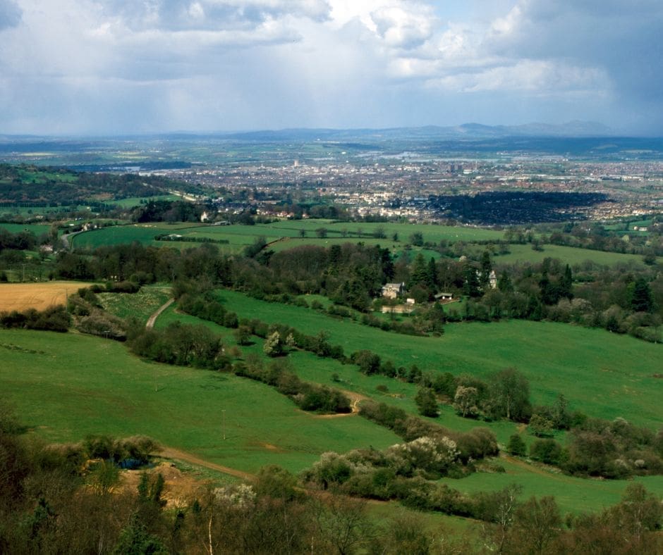
The Painswick Beacon Circular is another popular walking route in the Cotswolds, known for its stunning views and varied terrain. Painswick Beacon is a prominent hill located near the charming village of Painswick in Gloucestershire, England. The circular trail typically starts and ends in Painswick and covers approximately 5 miles (8 km) of scenic countryside.
The trail takes walkers through a mix of woodland, open fields, and heathland, offering panoramic views of the surrounding Cotswold landscape along the way. Highlights of the walk include the historic Painswick Beacon Hill Fort, an Iron Age hill fort dating back over 2,000 years, and the famous Painswick Rococo Garden, known for its beautifully landscaped grounds and unique architectural features.
Like the Cleeve Hill Circular Trail, the Painswick Beacon Circular is well-signposted and relatively easy to navigate, but it's still a good idea to bring a map or guidebook. Make sure to wear appropriate footwear and clothing for the weather, as conditions can vary, especially at higher elevations.
Overall, the Painswick Beacon Circular offers a rewarding outdoor experience, combining natural beauty with a sense of history and heritage. It's a great option for walkers looking to explore the Cotswolds and enjoy the tranquility of the English countryside.
Creator
MedalMad
Rating
Gallery
1. Start to B4073
2. B4073 to Gate
3. Gate to Kissing Gate
4. Kissing Gate to Lane
5. Lane to T-Junction
6. T-Junction to Holcombe Farm
7. Holcombe Farm to Upper Holcombe Farm
8. Upper Holcombe Farm to Bear Right
9. Bear Right to Dry Stone Wall
10. Dry Stone Wall to Wysis Way
11. Wysis Way to Painswick Beacon
12. Painswick Beacon to Golf Course Road
13. Golf Course Road to End
14. Start
15. Finish
16. Painswick Beacon Circular
| Distance: | 8035 |
| Elapsed Time: | 7246 |
| Avg Speed: | 1.111111111111111 |
| Min Altitude: | 137 |
| Max Altitude: | 280 |
| Climb: | 290 |
| Descent: | 290 |